
I conclude my series from New Orleans with a visit to the areas beyond the central city and tourist district, areas hardest hit by Katrina. Consider the following overall map of New Orleans:
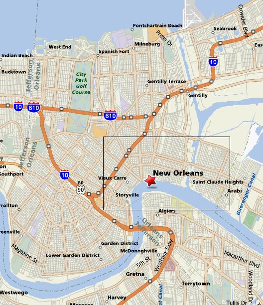
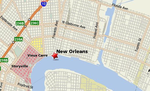
The Garden District and Tulane University (where the ICMC conference was held) are in the lowel left section. The rectangular area encompasses much of downtown as well as the French Quarter and the Fauborg-Marigny district (home of the Spotted Cat featured in my article on night life). These are highlighted in red and yellow, respectively, below:
To the east of Marigny are the Bywater neighbhood and the Lower Ninth Ward. The latter is probably known to many readers as the site of some of the worst flooding and destruction from the storm.
Heading out of Marigny north on Elysian Fields Ave., the trendy crowded neighborhood gives way to a more spread-out “Los Angeles” style area of separated buildings, convenience stores. Much of this area appears to be functioning again. We then turn east onto Claiborne Ave. (LA 39), one of the main east-west streets in New Orleans. Heading east, one sees more and more of the severly damaged houses, but the scope of the disaster is most apparent after crossing the canal on a large bridge and descending into the Lower Ninth Ward:
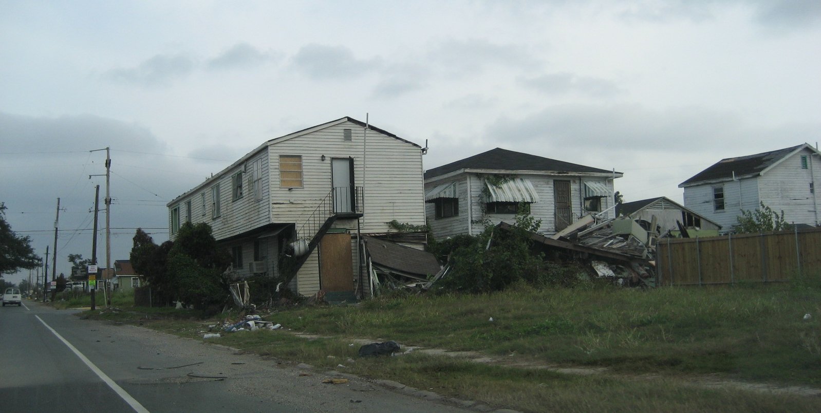
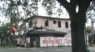
It is more than destroyed homes. Entire blocks are either in ruins or empty, all the businesses are boarded up or destroyed. While there is car traffic and some work on houses, the district seems largely empty and devoid of people and activity:
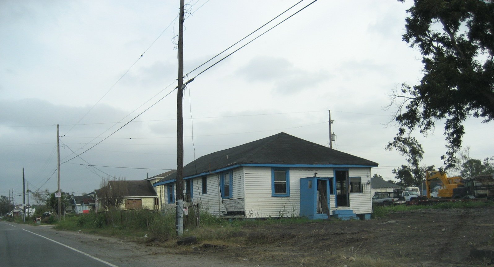
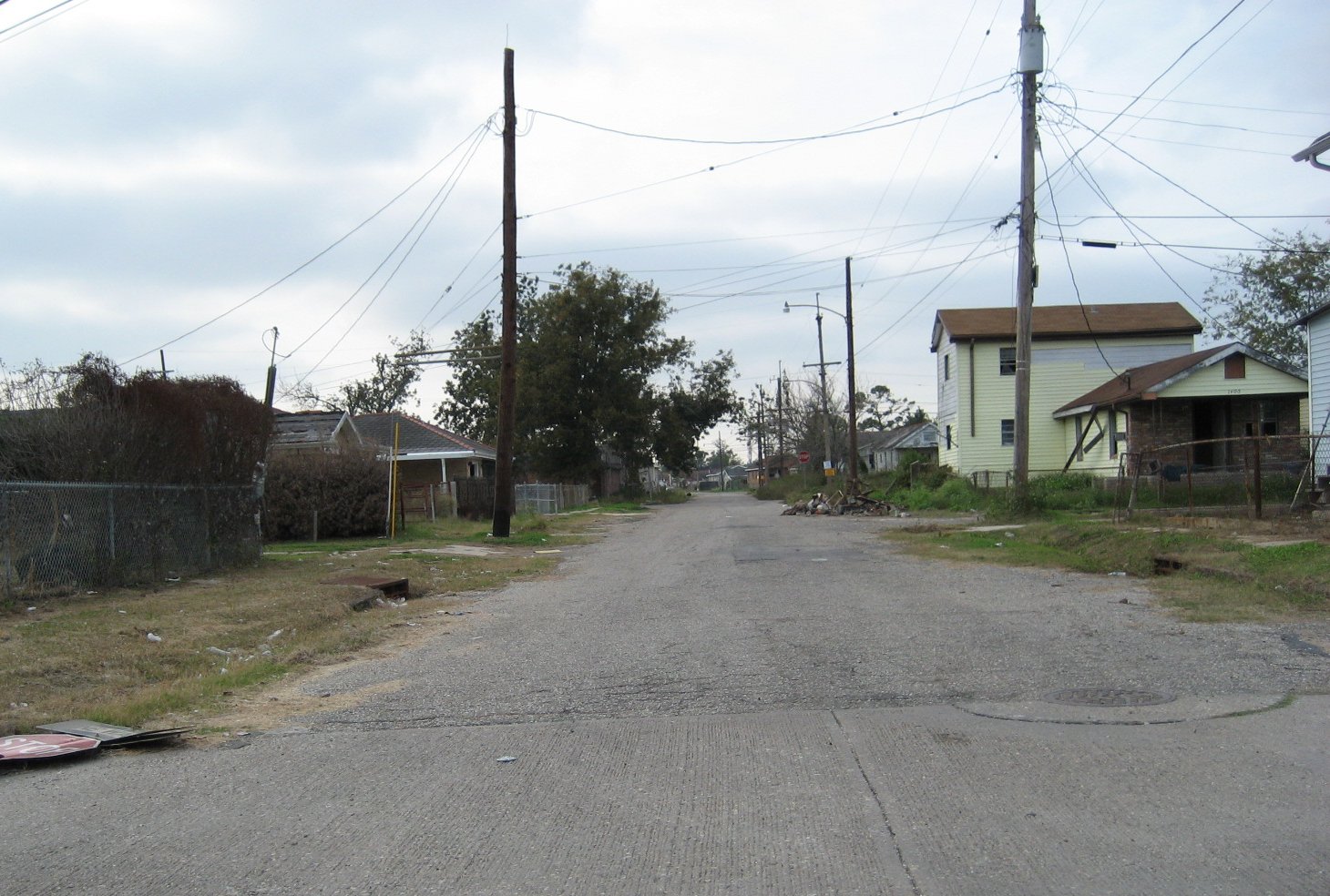
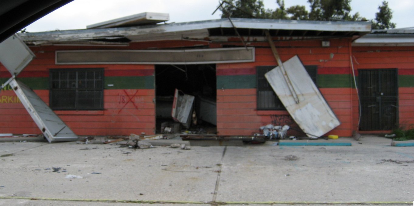
The photos really don't capture the experience in the Lower Ninth Ward. Imagine the images above extending in every direction around you, with no end in sight. These really are ruins of a city. And it should be noted that this is over a year after Katrina and the promised rebuilding and recovery. Part of me thinks that this area should be left this way as a “monument” of sorts – though I suspect the former residents might feel differently.
Heading back west over the canal on Claiborne, we rejoin Elysian Fields heading north towards Lake Ponchartrain. Many of the neighborhoods along the lake were also hard hit by the storm and flooding:
Unlike the Lower Ninth Ward, the areas along the lake do show signs of recovery and of life.
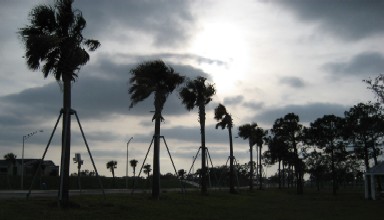
Arriving at the lake is another experience again. It felt a lot like traveling across San Francisco on Geary from downtown west to the ocean, a quieter area with rough waters and windswept shoreline:

The wind, water and trees provide a quiet, almost peaceful, contrast to the devastation, some of which still can be seen only a few blocks south. But one can see in the waves of the lake, only feet below the flood line on a normal somewhat story day, echoes of the storm surge. It was after all the lake and not the Mississippi River that provided much of the initial flooding.

It is here along the lake that I close this article and my reports from New Orleans. The surreal mixture of natural tranquility and destruction seems a fitting contrast and completion to the music and food, the busy conference and stately manors, streetcars and cats. Somehow it all works together.
new orleans
katrina
flooding
lower ninth ward
lake pontchartrain
LA 39
LA 46
I-10